CAD
DXF R2018 and R2000 with units set, DXF R12 on request, DGN v7 with feet master units. Contours, flow paths, ranked areas, boundaries on named layers.
RTK drone mapping · western Pennsylvania
Terra Vector turns one drone flight into numbers your team acts on: where the water sits, what the machines moved, what is left to grade.
From delivered jobs: a 500-acre private club in Allegheny County and a 60-acre residential development in Butler County.
Earthmoving contractors
A progress flight every week or two, and the numbers that come out of it: what was cut and filled since the last flight, what is left against the design surface, and how big each stockpile is. Everyone on the job opens the same 3D model and map in the browser.
Progress flights from $500 per event
Book a progress flight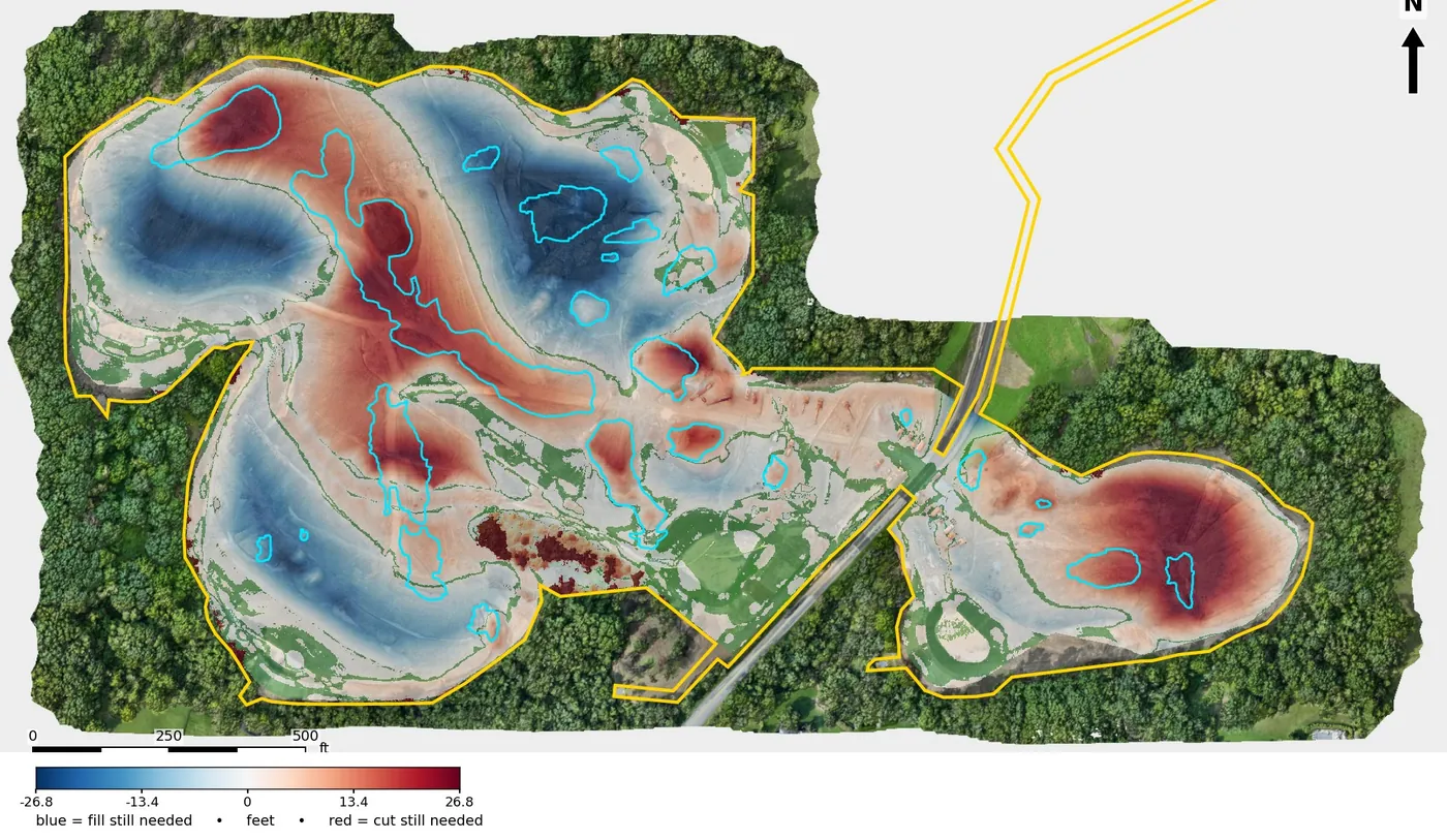
Golf courses and turf
One RTK drone flight gives you a drainage map, flow paths and 2 ft contours your architect can open. Delivered in days, not weeks.
Best capture windows: November after leaf drop, and March to April before leaf-out. We fly on maintenance days, never over golfers.
Drainage Snapshot from $3,500 18-hole course up to 200 acres, within about 60 miles of Pittsburgh
Book a free 15-minute 3D walkthrough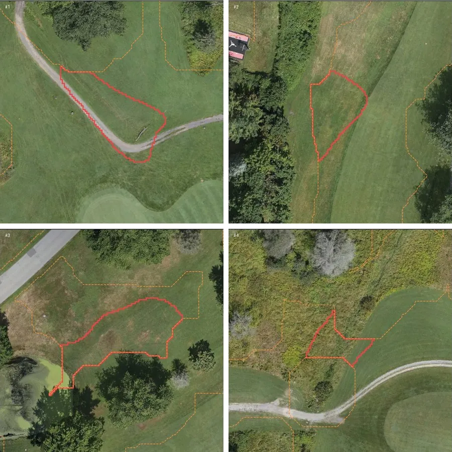
Consultants, surveyors and architects
You already have the contours. Send the survey (DWG or DXF in state plane, NAVD88) and a georeferenced orthomosaic, and get back a drainage analysis in your own drawing frame: ranked turf ponding with depth and volume labels, flow paths, basins and a written report. No flight needed.
Analysis from your survey data from $450 per course Reviewed analysis with a walkthrough from $950
Send a data package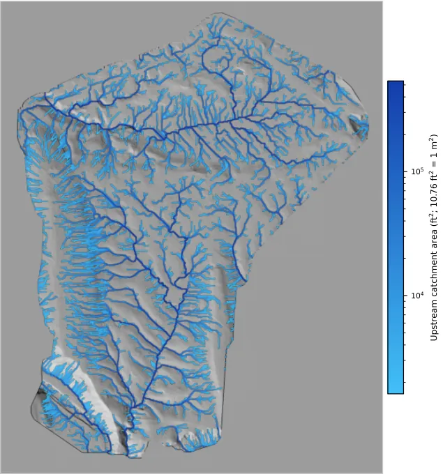
Files your CAD and GIS people open on the first try, in your coordinate system.
DXF R2018 and R2000 with units set, DXF R12 on request, DGN v7 with feet master units. Contours, flow paths, ranked areas, boundaries on named layers.
Shapefile, GeoJSON and CSV attribute tables. 3-band LZW GeoTIFF with world files (.tfw) and projection files (.prj).
PA State Plane in US survey feet (or UTM), elevations in NAVD88 feet, checked against USGS 3DEP. Planning-grade mapping, not a stamped survey.
Orthomosaic, digital surface model, point cloud (LAS) and textured 3D mesh, all viewable in your private portal and downloadable.
Earthwork progress or drainage report as PDF and a companion web page, with the method and the limitations written down.
A private web portal per site: 2D map, 3D model, measurements, flight-to-flight comparison, downloads and expiring share links.
Fifteen minutes on the site, the boundary and what you need to decide.
RTK-positioned DJI Matrice 4E, planned around your boundary, on a day that suits the site.
Photogrammetry, datum check, and the analysis you asked for, reviewed before it leaves.
Online in 3 to 5 business days. Repeat flights are compared with the last one.
Coming next
A small RTK box on each machine, one base per site, and a daily as-built and productivity report per machine: hours working and idle, distance, cycles, and what each machine cut and filled. No CAN bus needed.
Live machine tracking pilots start with a western Pennsylvania contractor in the coming months. Ask to be on the list.
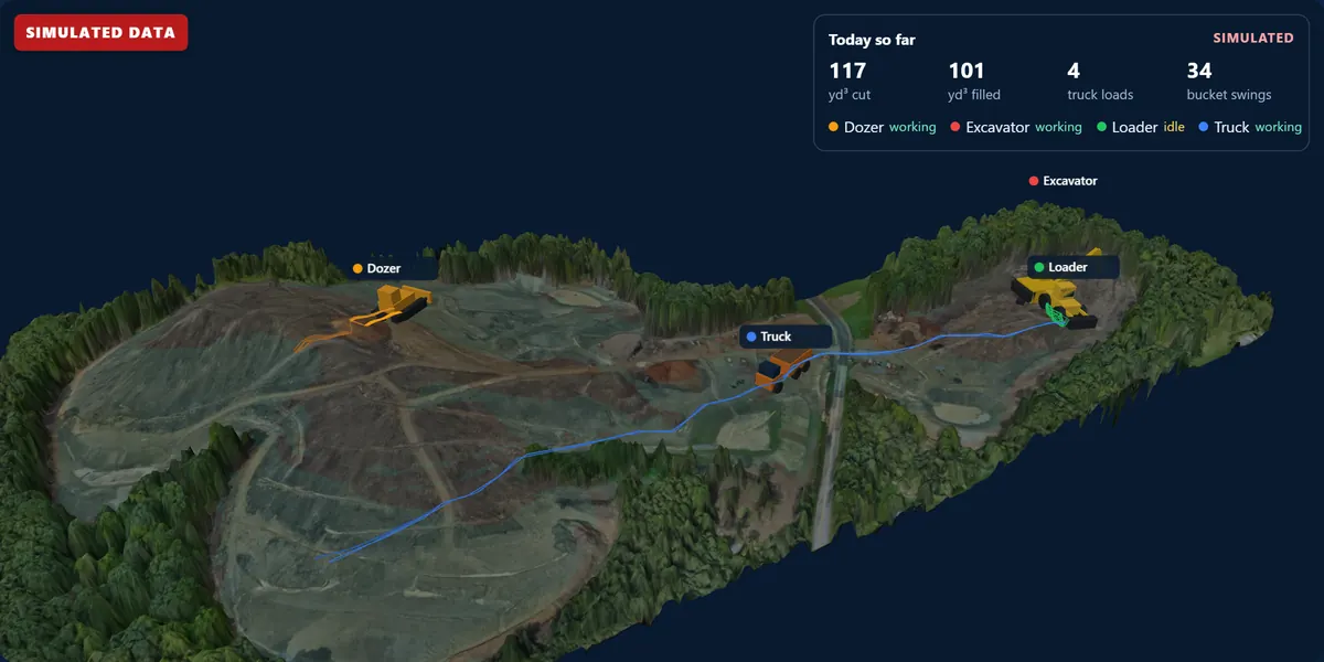
The site model is real: a drone survey of an active residential development, shown without its name. The machines are simulated: their positions, hours and volumes come from a simulator driving four machines over that terrain, sending data through the same interface a real tracker will use. We label it SIMULATED everywhere it appears. Live tracking starts with our first pilot.
It is planning-grade mapping from RTK drone imagery: accurate enough for 2 ft contours on open ground, progress quantities and drainage planning, but not a stamped survey or an engineering design. We work alongside your surveyor or engineer when you need one.
NAVD88 feet, checked against USGS 3DEP, with horizontal coordinates in PA State Plane (US survey feet) or UTM. Tell us your drawing's units and datum up front and we deliver in them.
Early to mid November after leaf drop, or mid-March to mid-April before leaf-out. Summer works for open turf; wooded areas are masked out. We fly on maintenance days or before the tee sheet opens.
Every one to two weeks during mass grading, and at each pay-application milestone after that. Each flight is compared with the previous one automatically.
Only the people you share it with. The portal is private, and share links expire and can be switched off at any time.
We reply within one business day. Prefer to talk? Leave your number in the form and we will call you back.
Service area: western Pennsylvania, about 60 miles around Pittsburgh; farther by arrangement.